This mystery laden chapel lies on one of the islands in the group called Signildskär far out in the west in the Åland Sea, and the place has always been an important anchoring point on the sea route between Grisslehamn in Sweden and Eckerö in Åland.
Exactly when a chapel was erected on the island is not known. To secure the delivery of post and the sea traffic Gustavus Vasa ordered the island to be inhabited all the year around. In 1538 “Sancte Signildskär” is mentioned for the first time in written sources, without actually mentioning a chapel. By the 18th century there is mention of a ruin in the place. The chapel is surrounded by myths. According to the legend it is connected to an English princess called Signel, or Signella, who escaped to the island from her enemies, and here built a chapel in gratitude of her salvation. To the same legendary group of islands belongs another island with the enigmatic name “Heligman” (Holy Man).
A detailed documentation of the ruin, written by the vicar at Hammarland, P.U.F. Sadelin, was published in ”Finlands Allmänna Tidning” in 1853.
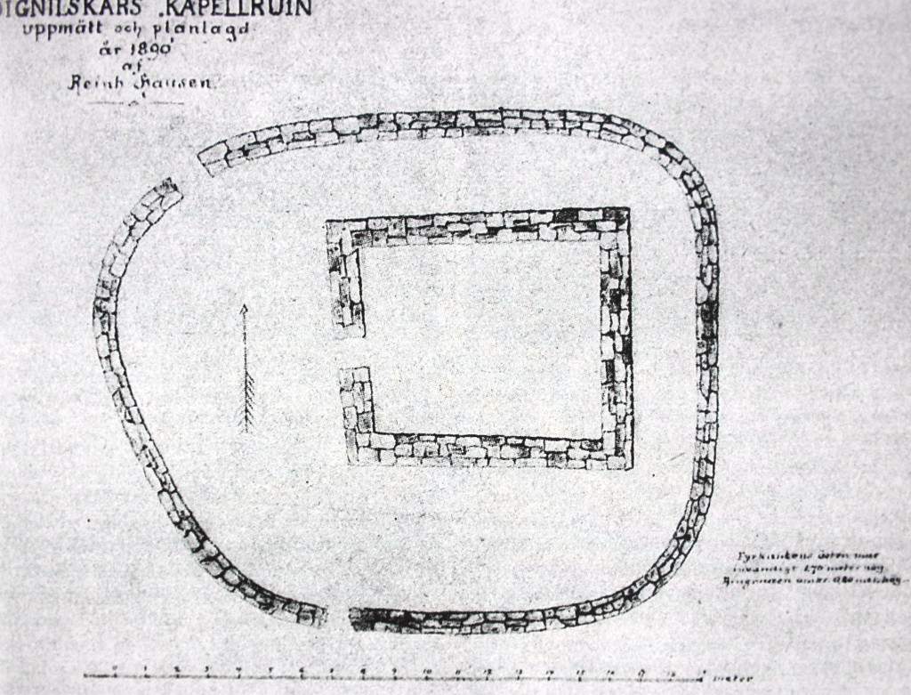
When this island first received an inhabitant can, as no sources are available, not be recorded. Due to its position it was probably visited early, maybe already by the Romans. At least, since the Viking Age seafarers, who maybe then erected the so-called chapel on the island, of which there are still ruins, have often called it upon. This chapel consists of a building in gray stone, with a thickness of 2½ ells without any mortar between the stones. This building measures 12½ ells in length, 10½ dittos in width and it is 3 dittos high and it has probably been covered by boards. The same building is surrounded by a courtyard with a low grey stonewall, which on the north side is laid at a distance of 11½ ells from the house itself, while the distance on the other walls measures only 3 ells. On the western side, under this enclosure, runs a ditch for draining water from the closed courtyard. In olden times seafarers probably used this building was probably for worship, and the courtyard as a burial place for those deceased during the journey. Discoveries of bones have been made on the latter. According to an old tale on the island a queen who was escaping from an enemy built this chapel.
“Signilskär’s chapel ruin” measured and “planned” in 1890 by Reinh. Hausen.
When translated into meters the measures above are approximately as follows: the thickness of the walls 1.5m, the length 7.7m, the width 6.5m and the height 1.8m. There is interesting information on the lack of mortar and on the enclosed courtyard functioning as a burial place for those who had not survived the voyage. Reinhold Hausen did a documentation drawing of the site in 1890, and confirmed the information given by Sadelin. In the ruin there was only one opening, towards the sea in the west.
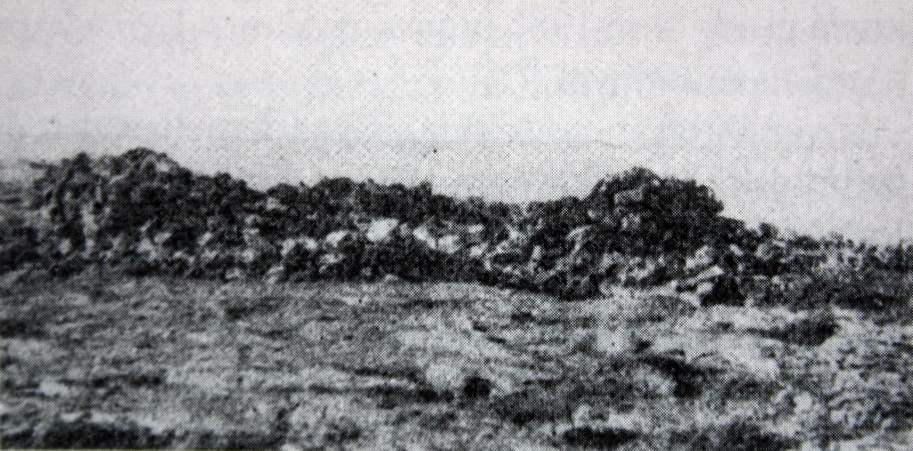
Chapel ruin at Signildskär. Photographed in 1923, before the reconstruction in 1948.
Unfortunately, a Finnish patrol leveled the ruin in 1940, when the fortifications from the Winter War were to be destroyed. Matts Dreijer archaeologically investigated the chapel in 1948, whereupon the ruin was reconstructed. The excavations confirmed that the chapel was erected on top of a cleft in the rock running in the north northwest-south southeast direction. The remains of two skeletons were discovered at the clearing of the cleft. Odontological investigation of the teeth showed that the skeletons belonged to two elderly men buried in the cleft. 14C AMS analysis of the chin bone of one of the men showed that the burial took place some time between 1470 and 1655. In the cleft were further found around 40 coins, most of them Swedish. Two of them belonged to the 13th century although the great majority of the coins dated from the 14th century.
Even if the chapel does not follow the more significant sailing route of the Danish Itinerary, it is still of medieval origin, possibly from the end of the 13th century. A medieval pilgrims road is the likely predecessor to the Post-Reformation postal road, which from Signildskär continued to Eckerö and further straight across the main Åland island to Vårdö, Kumlinge and Brändö, and across the waters to Kustavi in Finland Proper.

